Topography is responsible for the description of the surface.
It is important to highlight the etymological origin of the term topography in order to better understand its meaning. In this case, it is found in Greek where we discover that it is determined by the union of three clearly differentiated parts: topos which can be translated as "place or territory", the grapho verb which is synonymous with "write or paint" and the suffix – ia which is equivalent to “quality”.
The discipline or technique that is responsible for describing in detail the surface of a certain piece of land is known as topography . This branch, as it is said, focuses on the study of all the principles and processes that provide the possibility of transferring the particularities of the surface to a graph, whether natural or artificial.
Topographic maps
Surveyors use two-dimensional systems on the X and Y axes for their task, while height constitutes the third dimension. The elevation of the terrain, in any case, is reflected in topographic maps through lines that join a reference plane, known as contour lines.
These maps are characterized, therefore, not only because they represent the relief of the given surface at a clearly defined scale, but also by the fact that they have the advantage of representing a very large area of a territory such as a province or even a region.
The latter circumstance is what acts as the main difference with respect to what are called topographic plans that refer to a smaller area of territory. Among their hallmarks are that they are usually divided into grids equivalent to a real kilometer of the aforementioned territory, and that they have so-called legends.
The latter are elements thanks to which anyone who has one of these plans in front of them will be able to perfectly understand what is represented in it. And they determine what symbols identify rivers, trees , buildings, roads or even bridges. In the same way, it must be emphasized that these documents are usually used in the development of outdoor activities.

Topography allows the development of maps that represent the relief.
Importance of topography
It should be noted that topography has great value for sciences such as agronomy , architecture , geography and engineering . The application of geometric concepts to describe physical reality is very important in agricultural activity or in the construction of buildings, for example.
The topographic activity has a double dimension: it is necessary to visit the place in question to analyze it with the appropriate instruments, while in a next stage it is required to transfer the collected data to a cabinet or laboratory for interpretation and the development of maps.
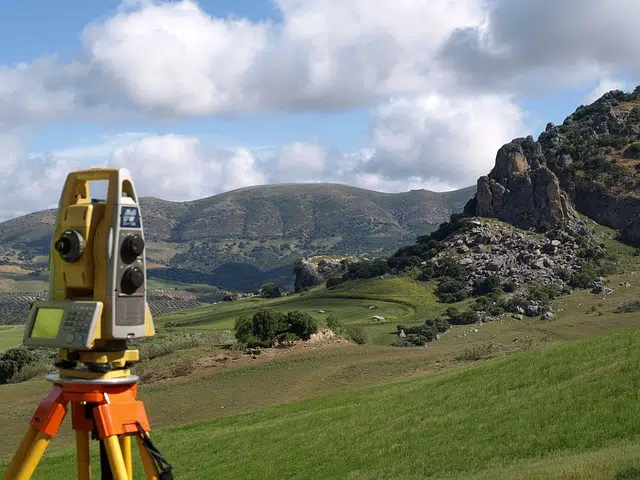
The total station
The device that is needed and used to measure paths or distances and both horizontal and vertical angles is known as a total station . By knowing the coordinates of the site where the station was installed, the three-dimensional coordinates of any point being measured can be established.
When these coordinates are processed, the surveyor can begin to graphically represent the details of the surface.