The puna is a high terrain that is close to the Andes mountain range.
Puna is a term that derives from the Quechua language. The concept is used to refer to the high terrain found near the Andes mountain range . For example: "The llama is a typical animal of the Puna" , "On vacation we visited several towns in the Puna" , "The Puna is very arid: that is why it is difficult to cultivate crops successfully in the region" .
What is understood by puna may vary according to the country. At a general level it can be said that the puna is a plateau that is located in a mountain area, located in the Andean region. Peru , Chile , Bolivia and Argentina are, in this sense, the countries that have puna.
Characteristics of the puna
Among the natural characteristics of the puna, we can mention the cold climate, the low level of precipitation, the low amount of oxygen in the air due to the altitude and the low atmospheric pressure. Another of the peculiarities of the puna is the thermal amplitude: the days can be hot and the nights, very cold.
Beyond the common characteristics , it is possible to differentiate different regions of the puna. The southern puna , also known as the arid puna , records less than 400 millimeters of rain per year. Within the southern puna you can recognize the desert puna and the dry puna . The northern puna or humid puna , for its part, exceeds 400 millimeters of rain per year.
The llamas , the guanaco , the alpaca , the vicuña , the puma , the Andean fox , the skunk and the condor are some of the typical animals of the puna, which is home to bushes, grasslands and meadows of different types.
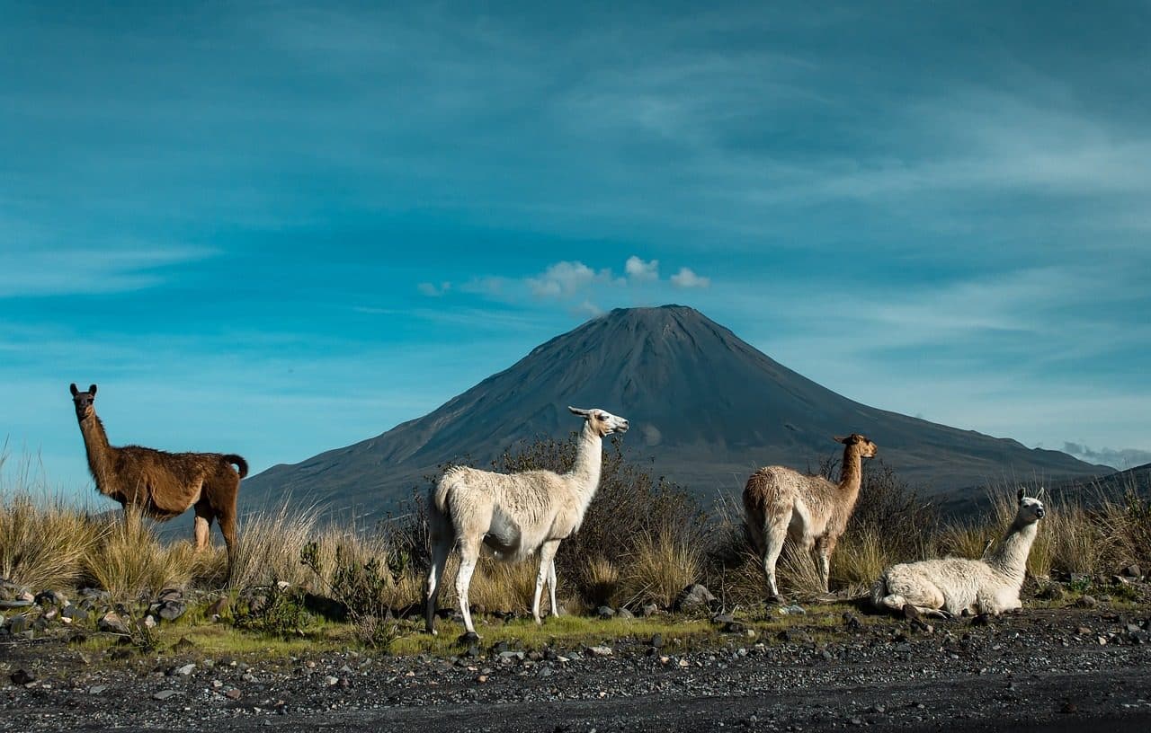
The alpaca, the llama, the vicuña and the guanaco are typical animals of the puna.
A desert plateau between Argentina and Chile
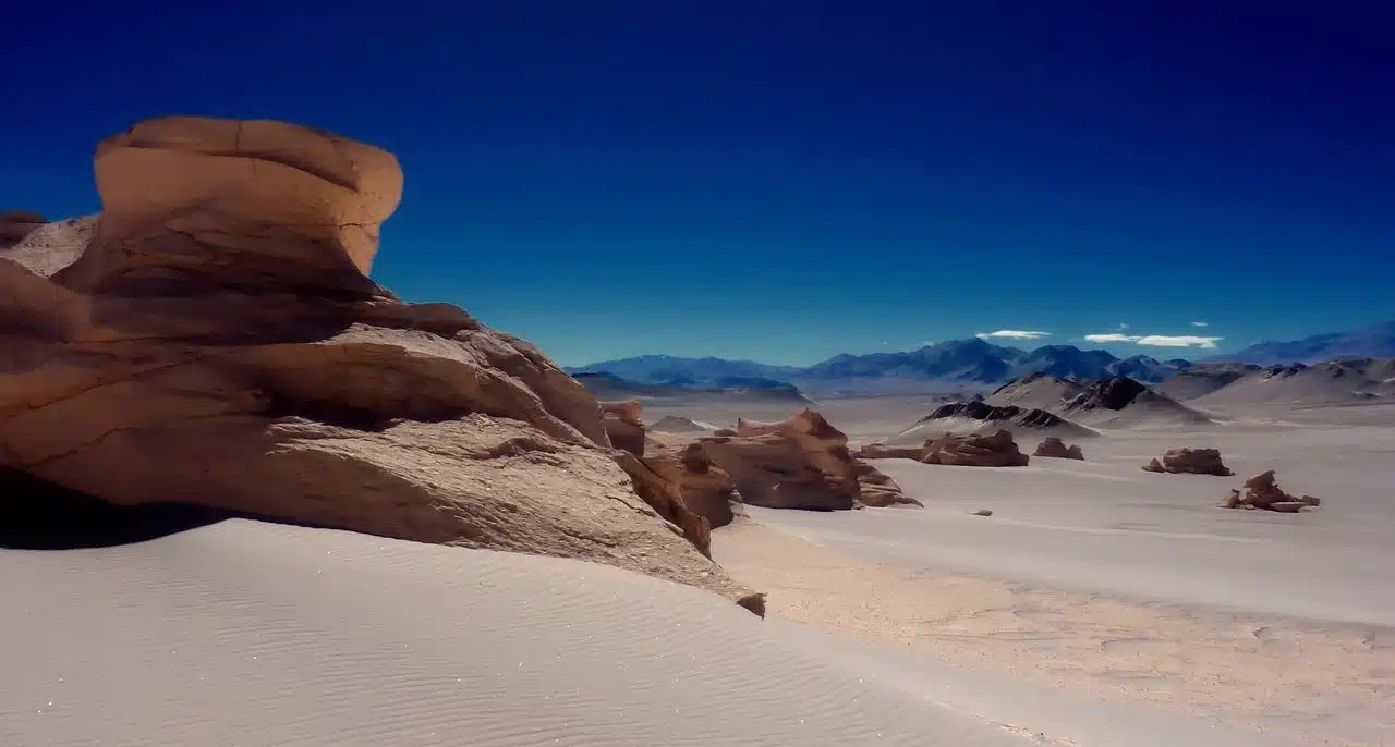
The Atacama Puna is a desert plateau shared by Argentina and Chile , 85% and 15% respectively. On its surface you can see a series of mountain ranges that cross it, which are at a high altitude with respect to sea level, but not so much if we start from the plateau , and run through the Andes mountain range in its entirety. and from each of its ends.
This puna is located in a very arid desert that continues the Atacama desert, the driest in the world. Except for the Loa River (which, in its 420 kilometers of extension, crosses the desert just mentioned and reaches the Pacific Ocean), none of the other water courses of the Atacama Puna flow into the sea.
With respect to its relief , it is characterized by a notable diversity, although undulations predominate, with plateaus in which there are endorheic basins (areas in which the water does not have a fluvial outlet in the ocean) with lagoons and lakes, the majority of them alkaline or saline, and long salt flats (such as those of Antofalla, Pastos Grandes, Atacama, Pocitos, Hombre Muerto , Incahuasi and Arizaro ), but also small valleys called plains and narrow ravines.
The most important Andean folds of this puna, which are located throughout its surface, are the following: the Sierra de los Pastos Grandes ; the Incahuasi volcano; the Copper Mountains ; the Toconquis hills mountain range (which includes Galán hill ); the Cachi mountain range (where the summit of Libertador General San Martín is located); and the Diamante hill.
Among the plant species of the Atacama puna there is a predominance of xerophiles that have adapted to the scarcity of water, soils with little organic matter and a high level of heliophany (the time the sun shines). Its climate is mainly high-altitude continental , with a wide range of temperatures throughout the day; It is a very dry region, very hot in summer and very cold in winter.