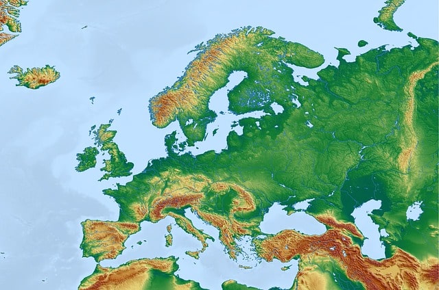
A physical map presents information about the geology of a terrain.
A physical map is a term made up of two words; We will try to reach a correct definition by breaking down the meaning of each of them.
First of all, map is a term that descends from the Latin concept of mappa , and refers to a drawing that represents a territorial region. It is usually developed on paper or another flat element, but there is also the globe, which is a type of spherical map. Physical , on the other hand, is an adjective associated with the body, which is opposed to the abstract or symbolic.
From the fusion of these two words we can understand that a physical map is a graphic representation on paper of the physical aspects of a place, terrain , geographical features and other related aspects.
The physical map, a type of map
The notion of a physical map refers to a particular type of map that displays the natural phenomena of the geology of a terrain and allows us to understand its composition.
On a physical map, we will find a representation of rivers , mountains and deserts , for example. In this way, physical maps are clearly differentiated from political maps , whose purpose is to portray the organization of a territory arranged by humans through entities such as countries , provinces or cities .
It should be noted, however, that there are physical-political maps . As their name indicates, these maps present both geological phenomena and political entities.
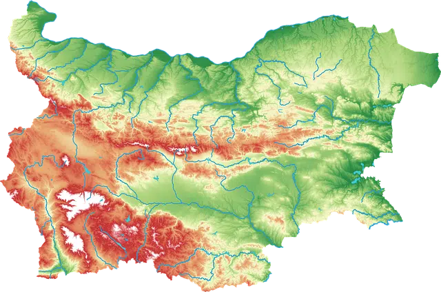
Mountains, rivers and deserts are some of the elements represented on a physical map.
Use of a scale and colors
Physical maps are made to scale and respecting metric properties, which helps the user to calculate surfaces and distances easily. Those in charge of developing maps are cartographers , experts in the discipline called cartography .
These representations are carried out using different colors, according to the altitude of the terrain or depth, these colors are more or less dark. For example, the sea water surrounding the coast is painted in light blue, while the ocean is dark blue, to explain that in the first case the depth is less than in the second.
The names of the most important cities are also recorded on these maps, but without making their limits clear (for this it will be necessary to observe a political map ).
Elements of a physical map
It is necessary to clarify that any map is made up of a certain number of elements, these are: Space and location (it represents a certain place with particular information), two-dimensionality (only two axes are recorded, width and length, depth is not recorded. This element is changing with the arrival of the third dimension to societies), verticality (they represent reality from a vertical perspective, it is as if the terrain is always seen from above), abstraction and idealization (it is carried out). an abstraction and the elements of terrain are represented through symbols established in a conventional way), scale (they are not made in real size but rather a representation is made on a scale where it is indicated how many times reality has been reduced when graphing; 1cm of the map can be equivalent to 1000 Actual km, for example), and references (indications that allow you to know what each represented symbol means and necessary dimensions to understand the map).
Physical maps can have different degrees of detail and coverage. That is, they can be from a small territory (municipality) or from a larger space (continent).
As technologies advance, map design becomes simpler; Currently, for example, most maps are made from aerial and satellite photographs, which allows for greater precision in their preparation.
To finish with this definition, it is important to keep in mind that, in another sense, the concept of a physical map is also used in genetics . In this case, physical maps represent the genes and genetic markers found on a chromosome . This representation is orderly and takes into account relative physical distance.