 GPS is the acronym for Global Positioning System , an expression that can be translated as Global Positioning System . This system was created by the United States Department of Defense and allows, through a network of 24 satellites, to indicate the position of a body on the Earth's surface with great precision.
The trajectories of these 24 satellites , which orbit at 20,200 kilometers above the Earth , are synchronized. In this way, coverage of the entire surface is achieved. GPS uses the mathematical method known as trilateration to work with the information provided by satellites and thus determine the location of the object.
To know a position , the receiving equipment (also known as GPS ) locates at least three satellites in the network, receiving signals from them that indicate the identification and time. By calculating the time it takes for signals to reach the equipment from the satellites, the distance between the devices is measured. Then, with these distances already established, it is possible to determine the relative position of the object (i.e., its coordinates).
Before continuing with the definition, it is important to note that many people confuse the concepts trilateration and triangulation, although there are clear differences. The fundamental thing is that the second relies on the measurement of angles, something that does not happen at all in the first.
Returning to trilateration, we must highlight the need to know the position of each of the twenty-four satellites at all times so that the GPS measurement is correct. In other words, if they could make a constantly random and changing path , then this technique would not work.
Let's see step by step the process that takes place to calculate the position of a GPS receiver. First, one of the twenty-four satellites must send a message to the receiver to have a first distance to serve as a reference. Throughout the day, a maximum of eight satellites are known to be in each major area of the earth, so we have plenty of points for testing.
 Once the system decides which satellite offers the appropriate distance to reference, it is time to move on to at least two others, although more can be used for more refined positioning. The idea is that by drawing an imaginary line between the GPS and the first satellite we also obtain a sphere, which indicates all the points where the first could be located; Since these are infinite possibilities, we need more measurements to narrow the search .
This system is not perfect, in that it does not provide results with one hundred percent accuracy . For this reason, we must accept a margin of error of a few meters. As technology advances, this can be disguised with complementary techniques, but at the moment we are not talking about exact positioning.
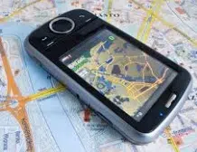
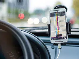
The most common use of GPS is in navigation , whether maritime, air or land. Many cars now incorporate GPS so drivers can easily locate themselves on a map. Also the most modern cell phones (mobile) usually include a GPS . Thanks to this service, we can travel a road unknown to us or find a point of interest in a city that we are visiting for the first time.
By allowing us to know the location of vehicles or people, GPS is used for rescue tasks and for the search and recovery of cars, to name two examples. A GPS on the phone together with certain applications, on the other hand, can be used to know where the user's contacts are located, showing the location on a base map.