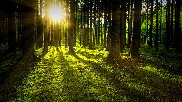
Geobotany describes the distribution of plants in space and time
Geobotany is the discipline that examines the link between vegetation and the Earth's surface . Also known as plant geography or phytogeography , it is responsible for investigating the distribution and habitat of plants on the planet.
Description and interpretation of species
Geobotany experts are dedicated to describing and interpreting the different modes of distribution of plant species in time and space . In their work they take into account the factors that determine this distribution.
What geobotany does, in short, is study how plant life develops depending on the terrestrial environment. This work has multiple scopes and is very important for human beings .
With geobotany it is possible to promote sustainable use of the soil , making the most of it but without neglecting its conservation. This field of knowledge also allows us to undertake restoration and recovery tasks if necessary.
Main objectives
At a more specific level, we must point out that geobotany's fundamental goals are the study of the following points:
* structure, composition and distribution in space of vegetation, both with respect to quantity and quality;
* as part of functional geobotany , productivity, so-called biogeochemical cycles and function;
* mesological aspects, which include soil and climate ;
* ontogeny and succession.
Relationship with other disciplines
First of all, we can mention some of the disciplines with which geobotany has been integrated for a long time. These include biogeography, biostatistics, botany, soil science, ecology, geology, physical geography and human geography . The list is longer and is enriched with the passage of time, and may also undergo modifications if some of these disciplines cease to exist or merge with others.
It is also correct to say that some fields of knowledge take advantage of geobotany to apply it practically in their procedures and research . Here we are faced with grassland, agriculture, forestry, the valuation of nature's heritage, the battle against erosion and territorial planning.
Vegetation map
This is called a fundamental tool for scientific research and technical work, since it is a very detailed documented source. Among the requirements for this type of cartography are the specification of the limitations in the technical field, the dominant ideas and the methods that correspond to each era and that have limited its realization.
Thanks to the vegetation maps made by geobotany, for example, you can have key information to manage a territory under rational criteria. Geobotany also helps to understand the reaction of plants to the characteristics of the environment .
Vegetation maps are key to the rational administration of territories
It is important to note that each vegetation map depends on different factors; They highlight the author's objectives and the elements he has decided to include , such as the scale and the legend. In this way, it is not easy to find two alike. However, with the technological advances of recent decades, a large part of the procedures have been automated, so that these differences have been diluted in pursuit of greater precision in reflecting reality.
as an adjective
It should be noted that the concept of geobotany (or geobotanical ) can even be used to refer to things related to plants and the terrestrial environment. A geobotanical route , in this sense, is a route that serves to appreciate how vegetation is distributed and grows in a certain area. A geobotanical reserve , on the other hand, is a space dedicated to the protection of plants from a specific geographic region.