Photogrammetry provides specific data on the characteristics of a terrain
Photogrammetry is the technique that uses aerial photographs to obtain plans of a large surface . This resource is used in the field of topography.
Three-dimensional measurement
Through photogrammetry it is possible to know the dimensions, shape and location in space of a body or land , since the measurements established on one or more photographs taken from the air are used.
With photogrammetry you can measure coordinates in three dimensions . In this way, specialists are able to generate a model that represents an object in all its complexity.
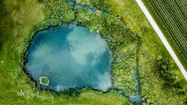
The development of maps and the generation of information on hydrology, cadastre, territorial planning and land occupation are some of the actions that can be carried out using photogrammetry.
It should be noted that drones have contributed to the advancement of photogrammetry. Nowadays it is possible to reach areas with difficult access and record the details of your land continuously.
Photogrammetry, in short, allows us to know the geometric and metric characteristics of an object or an area through aerial photographs that are taken in series. The superposition of the images serves to generate the three-dimensional effect.
The process
The first step in the photogrammetry process is to plan the flight . Then the shots must be taken and the images processed, which must be placed in the appropriate position. Finally comes the time for reconstruction and formation of the model, with the option of rectification or restitution .
Before starting, the so-called control points are placed on the ground to be used as visual references by the program; They can be stakes or paint marks, for example, as long as they are easily distinguished. The GPS used must be highly accurate, since it must relate these points to real coordinates on the map .
Photogrammetry in video games
The video game industry is one of the most important of the 21st century. Sometimes statistics indicate that it has long surpassed that of cinema, at least in terms of the volume of money invested and raised in large projects. One of the aspects that most attracts the general public is photorealism, that is, graphics produced by computer that reflect reality in a very faithful way. And photogrammetry is an ideal resource for this purpose.
While to create a fantasy world, such as Tolkien's Middle Earth, the characteristics of reality are taken only as a reference point, when reproducing a real race track the developers pursue the greatest possible fidelity with the technology that they have at their disposal. The American team Turn 10 , for example, takes advantage of photogrammetry to copy every detail of the world's most important tracks in its Forza Motorsport series.
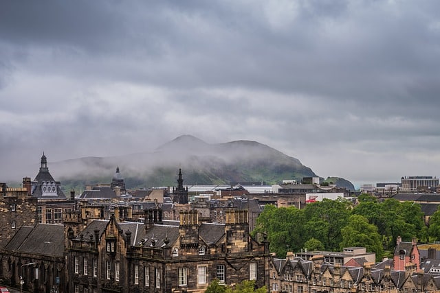
The game Forza Horizon 4 relied on photogrammetry to reproduce Edinburgh
Photogrammetry offers a considerable amount of information for the reproduction of a geographical space, but the most demanding are not satisfied simply with the appearance of objects, such as mountains, trees and buildings, but also pay attention to two other details that can be fundamental to achieve the best results: the direction of the sun and the characteristics of the sky.
In this last point, the climate and the characteristics of the weather at each time of the year also come into play. It is common in racing video games to simulate precipitation, the day-night cycle and other phenomena to show the tracks in different situations and times, making use of special effects and increasingly realistic lighting systems . Well, it is thanks to the data obtained by photogrammetry developers that they can faithfully represent all this.