
Altitude is the vertical distance between a point on land and sea level.
Altitude is the vertical distance between a point on earth and sea level . The term, from the Latin altitudo , is also used as a synonym for height in reference to a distance from the earth, to the region of air at a certain elevation above the surface or to the dimension of a body perpendicular to its base.
For example: "The shelter is at an altitude of 2,500 meters, so we still have to climb quite a bit to reach it" , "The satellite orbits at an altitude of 300 kilometers" , "The commander has just reported that we are flying at a altitude higher than normal to avoid a storm front .
Altitude calculation
To calculate altitude, sea level or mean sea level is usually taken as a reference. This point, however, is not constant due to the action of the tides and the differences that exist depending on the region. That is why each country usually determines a sea level according to a specific place and a certain time of year. The calculation of the altitude in a country, therefore, will be carried out based on said predetermined level.
Altitude is usually measured in meters . That is why we talk about meters above sea level (which may be abbreviated as masl ). Thus it can be said that the peak of a mountain is 1,850 meters above sea level or that the hotel is 400 meters above sea level.
While in European and most Latin American countries altitude is measured in meters, in the United States it is usually measured in feet .
The measuring instrument used to measure altitude is known as an altimeter ; Basically, it allows you to determine the distance between your location point and a reference point, and it is frequently used to know the height above sea level. It is not necessarily a stand-alone tool; Some bicycle speedometers, for example, have a built-in altimeter.
The altimeter is widely used in aeronautics, an area in which it has become one of the most significant flight instruments of an airplane, providing greater safety to the crew. On the other hand, it is also used in any activity, sporting or not, in which there are considerable unevenness, such as skiing, mountaineering, cycling, trekking , skydiving, trail running and climbing, among others, to know which unevenness is overcome. at every turn.
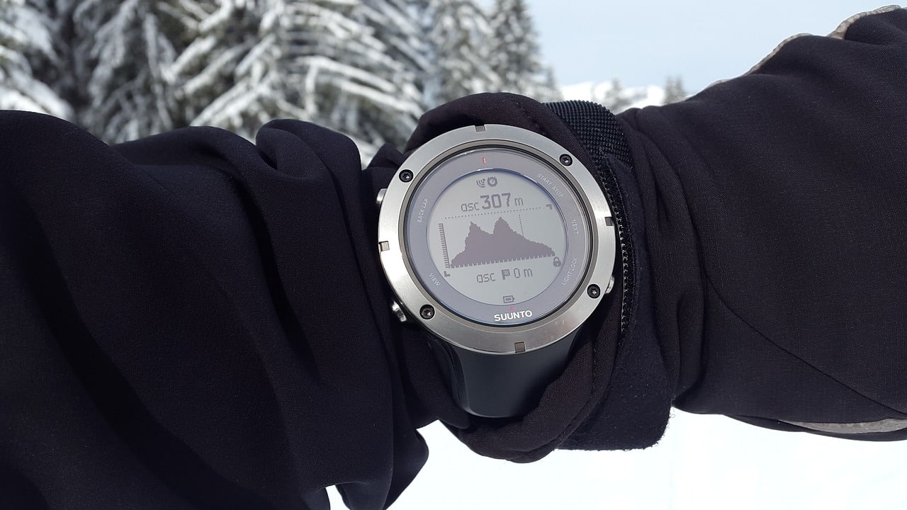
The altimeter allows you to measure height.
Thermal floors
Thermal, climatic, ecological or biotic floors are a concept related to the relative altitude of a relief and its influence on the climatic types of a given area, since these are the most important climate- modifying factors, especially in the area. intertropical (the strip located between the tropics of Cancer and Capricorn ).
In the intertropical zone, for every 1.8 m of height the temperature decreases an average of 1 °C, which may seem insignificant but represents a very important variation; This phenomenon is known as the thermal gradient and is what gives rise to the concept of thermal floors.
Some researchers speak of altitudinal geography to refer to the thermal floors in intertropical countries and, according to the author, four or five floors can be distinguished, each with characteristics such as average temperature, sunshine and precipitation so different from those of the rest to define a climate for each altitude.
It is very important to understand the great influence that altitude can have on the climate in the intertropical zone, and the precision that the concept of thermal floors provides when defining mountain climates.